Hunt & Palmer Land Records
Modern Section Index
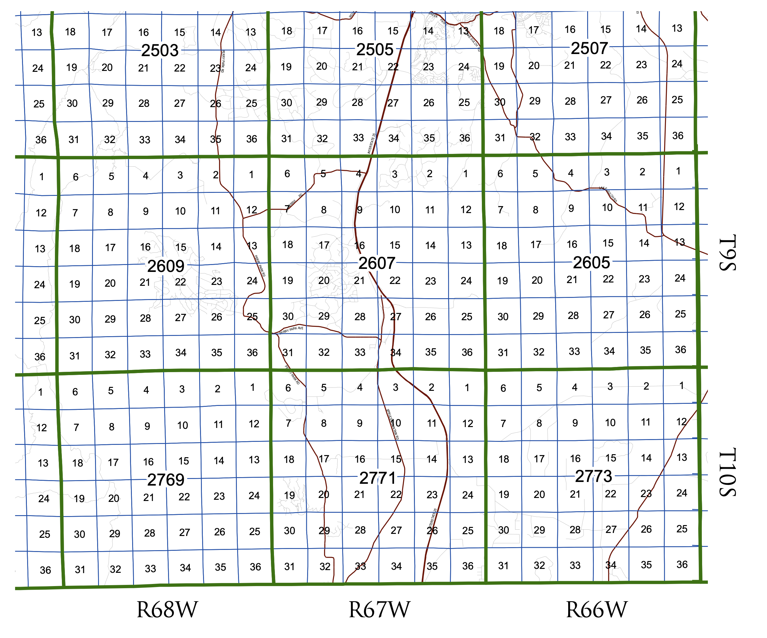
For reference, the township of interest (T9S R67W) from the Douglas County Assessor Section Index is Township 2607. The Section Index is very useful for visualizing the current ownership of the sections and being able to see exactly how Hunt put what is now JA Ranch together over time, and then sold it off.
The east-west red lines are Tomah Road and Perry Park Avenue.
Usage Notes:
How it works: the slider sets a “recorded through” year, and the map only lights up sections that already have a deed by that point — so dragging from 1870 forward shows the story unfold. You’ll see Palmer and Ellen Hunt grab their big patent blocks right at the start (1870), Alexander Hunt’s piecemeal buying fill in the T9S R67W core through 1872–1880, the eastern R66W parcels appear in 1881, and then the final 1886/1889/1892 transfers out to the railway, Drake, and the Douglas Lava Company. The two counters track active sections and cumulative records as you scrub.
Each section is colored by its most recent relevant deed as of the selected year, so a parcel Hunt bought in 1875 and sold in 1883 flips from green to red when you cross 1883. The detail panel now stamps every individual deed with its own Acquired / Disposed / Internal badge and a matching colored left border, and it respects the focal party too — switch the filter to just Palmer and a Hunt→Palmer quitclaim reads as “Acquired” for him while the same deed reads “Disposed” under a Hunt filter. Under “All parties” that same intra-group deed shows as amber Internal transfer, which is what makes the 1883 Hunt→Palmer consolidation pop out so clearly.